Drones in Land Surveying
Transforming land surveying, drones offer a modern approach to precision mapping and data collection. Elevate your surveying capabilities enabling faster and more detailed terrain assessments for enhanced accuracy and efficiency in land surveying projects.
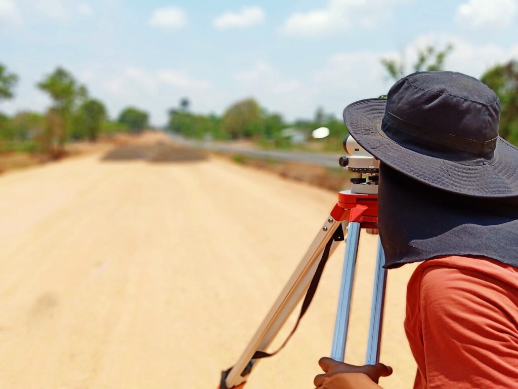
How to Use Drones in Land Surveying
Speed & Survey Success: 15 Mins, 50 Acres—Unlock Ultimate Efficiency with Drones!
Revolutionizing the landscape of traditional land surveying practices, drones emerge as the game-changer, redefining efficiency, precision, and cost-effectiveness. These aerial marvels offer an array of benefits that transcend the boundaries of conventional methods.
In essence, drones aren’t merely tools; they represent a transformative force, elevating the standards of land surveying by offering speed, safety, precision, and sustainability that traditional methods simply cannot match.
Minimize Field Time
Drones drastically cut down surveying time without compromising accuracy. By swiftly covering expansive areas in a fraction of the time traditional surveys require, drones enable the mapping and analysis of large terrains within a remarkably short timeframe. Picture this: what might take days or weeks using conventional methods, drones accomplish in a matter of hours or even minutes. This unparalleled speed doesn't just save time; it amplifies productivity and slashes operational costs.
Improved Safety
Drones enhance safety by minimizing the need for manual labor in hazardous or hard-to-reach terrains. Surveying rough terrain or inaccessible areas becomes a breeze, eliminating risks associated with on-site surveyors navigating challenging landscapes. This not only ensures the safety of personnel but also expands the scope of areas that can be efficiently surveyed, previously deemed too perilous or difficult.
Precise Data
Data gathered by drones boasts unparalleled precision and detail. High-resolution imaging and advanced sensors provide incredibly accurate and comprehensive data sets. This data doesn’t just offer precise measurements; it unlocks valuable insights for various industries, from construction and urban planning to environmental monitoring and agriculture
Enjoy faster data collection without sacrificing accuracy.
Drones revolutionize surveying efficiency by covering vast expanses of land in a fraction of the time it takes traditional methods. With rapid aerial maneuverability and advanced imaging technology, drones swiftly capture detailed data, reducing surveying timelines from weeks to hours or even minutes. This efficiency not only saves time but also amplifies productivity, enabling surveyors to focus efforts on analysis and decision-making rather than prolonged data collection.
Drones equipped with high-resolution cameras and advanced sensors produce incredibly precise data sets. These tools capture intricate details and measurements with unparalleled accuracy, surpassing the precision achievable through manual surveying. This high-fidelity data isn’t just precise in measurements; it offers comprehensive insights critical for various industries.
Implementing drones in land surveying significantly reduces operational costs. By streamlining the surveying process and cutting down on labor hours, businesses and organizations save on manpower and resources. Additionally, the swift data acquisition and analysis minimize project timelines, reducing overall project expenses and enabling faster decision-making, which ultimately contributes to cost savings.
Drones mitigate risks associated with on-site surveying, particularly in hazardous or challenging terrains. By eliminating the need for personnel to traverse difficult landscapes, drones enhance safety by reducing potential accidents or injuries. Surveying steep or inaccessible areas, previously deemed risky or impractical for on-site surveyors, becomes achievable and safe through drone technology.
Embracing drone technology aligns with environmental sustainability goals. Drones consume minimal energy compared to traditional surveying methods and significantly reduce disturbances to surveyed areas. Their non-invasive approach minimizes environmental impact, making them an eco-friendlier option for comprehensive land assessments and monitoring.
Drones offer unparalleled versatility, accessing areas that are otherwise challenging to reach. Their ability to navigate varied terrains, including rugged landscapes and densely vegetated regions, makes them indispensable tools for a wide range of industries. This accessibility unlocks previously inaccessible data, enabling comprehensive surveys and analyses crucial for informed decision-making in diverse fields.
How to Get Started

Free Training
Thinking of using drones in your business but you want to find out the process without spending a dime? Then our free Atomic Quickstart Program is for you. We'll give you step by step guidance to help you get your program off the ground.

READY 107 Test Prep
If you want to use a drone in your business, you'll have to be an official, real deal, FAA-obeyin', certificated remote pilot. To help you get there, we've got our READY 107 remote pilot test prep course, so you can ace your exam and get on with your career. Aviator sunglasses not included.

SkyMaster Skill Building
Our SkyMaster Skill Building Series is the perfect complement to our READY 107 test prep course or your already established drone program. From enhancing your flight skills to dealing with difficult encounters, we've got you covered beyond the basics.