Drones in Crash Scene Mapping
Drones are revolutionizing crash (and outdoor crime) scene mapping by providing efficient and accurate aerial perspectives. Drones empower professionals to leverage cutting-edge technology for swift and precise crash reconstruction, enhancing investigative processes and improving overall safety measures.
How to Use Drones in Crash Scene Mapping
Scene Documentation That's Almost Faster Than The Evidence Eradication Team
Drones aren’t just cool flying machines for epic aerial shots – they’re revolutionizing how we approach crash scene mapping! Buckle up, because these high-flying gadgets aren’t just for thrill-seekers; they’re the superheroes of crash reconstruction.
Picture this: a crash scene sprawled across the road, and you need accurate, detailed data pronto. Enter drones, swooping in like caped crusaders armed with high-resolution cameras and sensors. They zip around capturing images from every angle, mapping out the scene with precision that’d make even Sherlock Holmes jealous. Talk about turning chaos into clarity!
Faster Collection
Drones zoom through the sky, swiftly gathering crucial data in a fraction of the time it'd take traditional methods. And it's not just about being quick; it's about being thorough. These sky-bound wizards capture comprehensive 3D models and detailed imagery, leaving no stone (or skid mark) unturned.
Safer Scene Work
No need for a crash test dummy to risk life and limb in hazardous areas. Drones soar above, keeping everyone out of harm's way while doing the heavy lifting. Plus, they can reach tricky spots that humans simply can't, making sure every nook and cranny is accounted for in the reconstruction puzzle.
Budget Friendly
Traditional methods could burn a hole in your pocket, but drones? They're like the thrift shop find of crash scene mapping, giving you top-notch results without draining your budget. With the cost of hardware and software falling - any department can have UAS mapping within their reach.
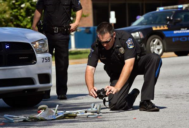
Atomic UAS co-founder, BJ Mullinax, investigating a non-fatal pedestrian collision in 2015.
Drones for crash scene mapping: Rapid, precise, and cost-effective data collection.
Zooming at top speed, drones gather detailed data in a fraction of the time it takes traditional methods. With their swift aerial maneuverability, they cover vast areas swiftly, ensuring no crucial information is missed in the accident reconstruction process. Imagine capturing a comprehensive overview of the scene in minutes rather than hours—time saved is clarity gained!
Drones act as safety superheroes, eliminating the need for personnel to navigate hazardous crash sites. They fly above, capturing images and data while keeping investigators and responders out of harm’s way. This elevated perspective ensures a thorough analysis without risking additional accidents or injuries, making the process both effective and secure.
Equipped with high-resolution cameras and sensors, drones meticulously capture 3D models and detailed imagery. These flying marvels leave no stone unturned, ensuring that every detail, from tire marks to debris patterns, is recorded with laser-like precision. The result? A virtual replica of the scene that investigators can dive into with confidence, reconstructing events with unparalleled accuracy.
While humans might struggle to access certain areas of a crash site, drones have no such limitations. They effortlessly reach tricky spots, such as elevated terrain or inaccessible angles, ensuring a complete mapping of the scene. Whether it’s dense vegetation or rugged landscapes, drones navigate through with ease, providing a comprehensive view that traditional methods might miss.
Compared to conventional approaches that can be resource-intensive, drones offer a cost-effective alternative. They minimize the need for expensive equipment or multiple personnel, reducing operational costs significantly. Their reusable nature and efficient data collection process make them a budget-friendly choice without compromising on the quality or depth of information gathered.
By streamlining data collection and providing detailed, accurate information, drones expedite the investigative process. The wealth of data they gather ensures that investigators and experts have a robust foundation to reconstruct events, analyze causes, and determine fault swiftly. This efficiency not only saves time but also enhances the accuracy of conclusions drawn, aiding in faster resolution and informed decision-making.
How to Get Started
Free Training
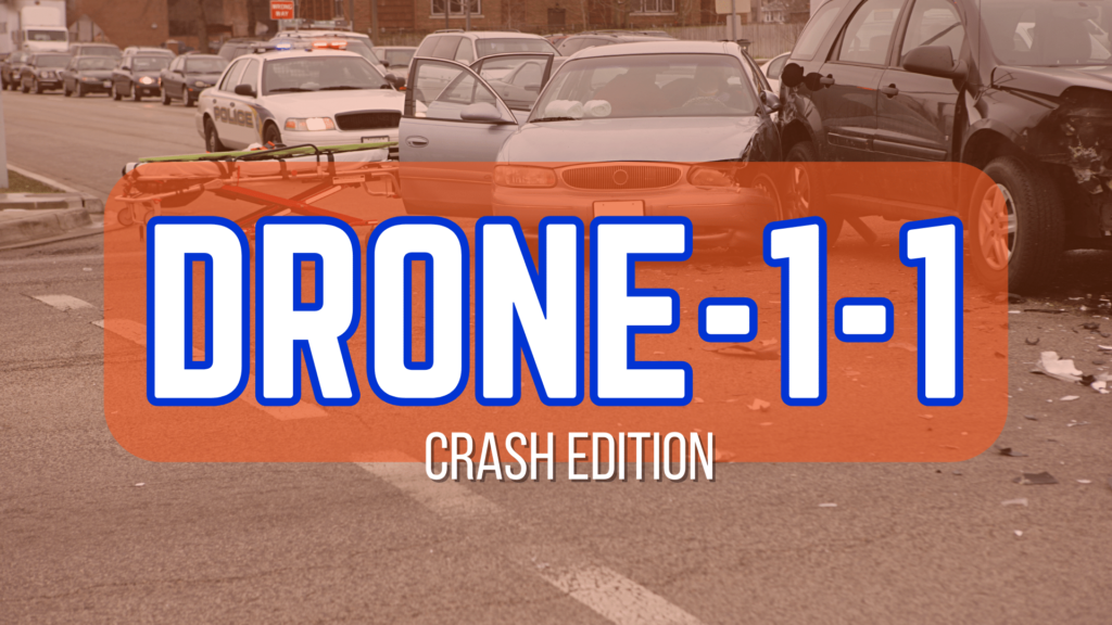
Thinking about making the mapping switch to drones for you crash (or outdoor crime) scenes? Need more information to make the pitch? Our Drone-1-1 Crash Edition is the perfect follow up to our regular Drone-1-1 free training. You'll learn exactly how to make the mapping switch.

READY 107 Test Prep
If you want to use a drone in your business, you'll have to be an official, real deal, FAA-obeyin', certificated remote pilot. To help you get there, we've got our READY 107 remote pilot test prep course, so you can ace your exam and get on with your career. Aviator sunglasses not included.

SkyMaster Skill Building
Our SkyMaster Skill Building Series is the perfect complement to our READY 107 test prep course or your already established drone program. From enhancing your flight skills to dealing with difficult encounters, we've got you covered beyond the basics.
Join the Flight Crew
Join our mailing list to get exclusive access to industry insider tips, the latest news in aviation training, and special discounts on courses. Sign up now and take your aviation career to new heights!